Major Maps: Academic Wayfinding Through Strategic Design
Dozens of academic programs. One cohesive system. A clearer path for students. | UVA Arts & Sciences 2025–2026
How do you help students envision their future in an academic program when every department has its own curriculum, priorities, and perspective?

Designed to spark curiosity, invite comparison, and help students find their next direction — Major Maps on display in Nau-Gibson Hall. Photograph by Evan Kutkso, UVA Arts & Sciences.
At the University of Virginia College and Graduate School of Arts & Sciences, I served as lead designer for Major Maps, a College-wide academic wayfinding initiative designed to help undergraduates explore majors, compare programs, and imagine their four years at Arts & Sciences.
Developed in collaboration with academic departments and the College's Office of Undergraduate Education, the maps have become part of the undergraduate advising framework while serving as an accessible resource for independent exploration.
Available through individual departments and displayed in public spaces, Major Maps give students multiple ways to engage: browse the covers, discover an unfamiliar field, hear directly from students about their experiences, and open a map to explore the academic path in greater depth.
Working across the College’s dozens of academic majors, I established the creative direction and production system for a new series of four-year maps, translating complex academic information into an approachable, consistent framework while preserving each program's distinct character. The print maps bring together coursework, advising, research, career preparation, and opportunities beyond the classroom, with complementary digital content extending the experience to department websites.
One system, many perspectives
The task wasn't just creating a good-looking brochure; it was building a visual and editorial framework flexible enough to represent dozens of disciplines while making the information clear, consistent, and useful to students.
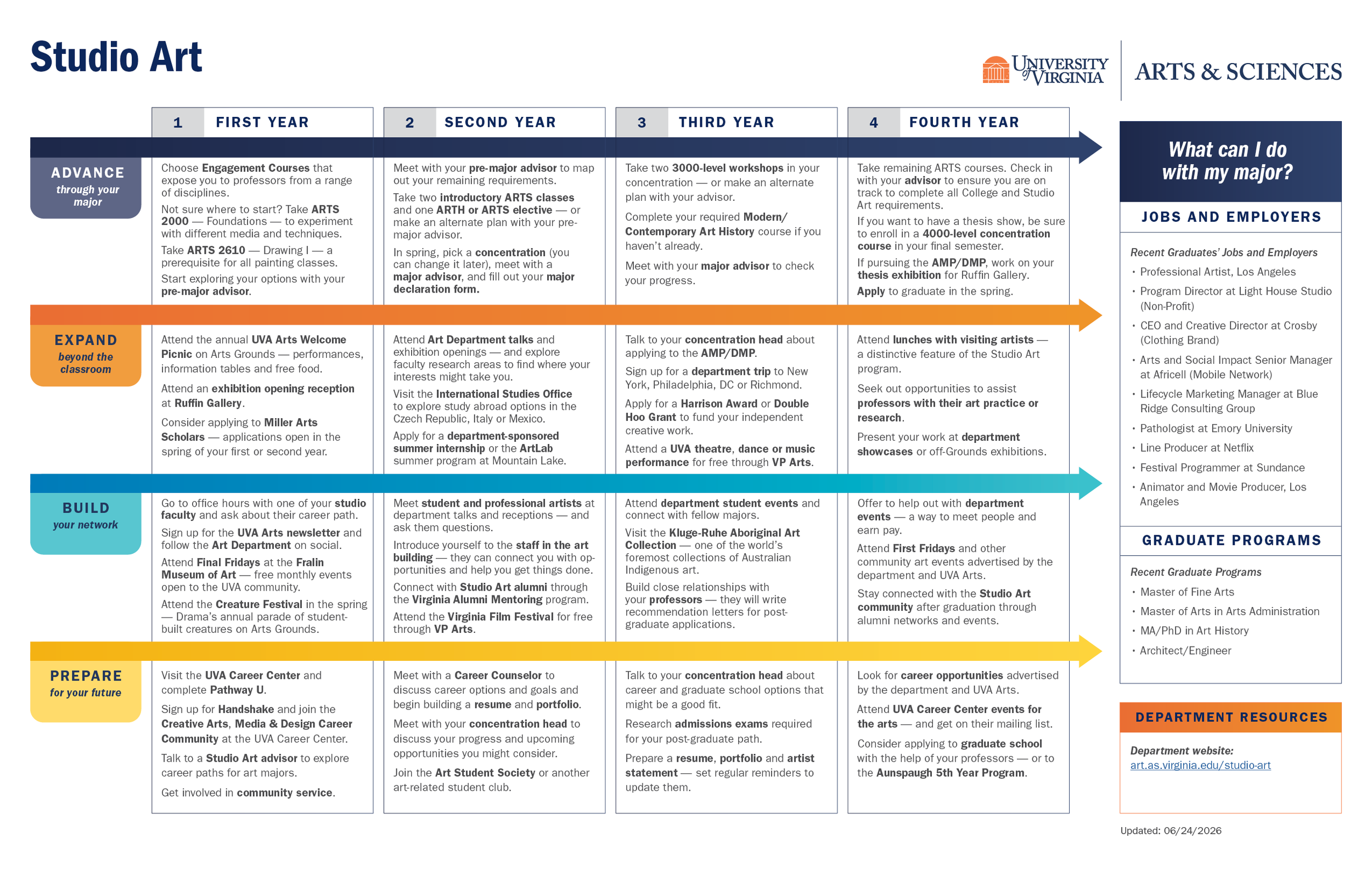
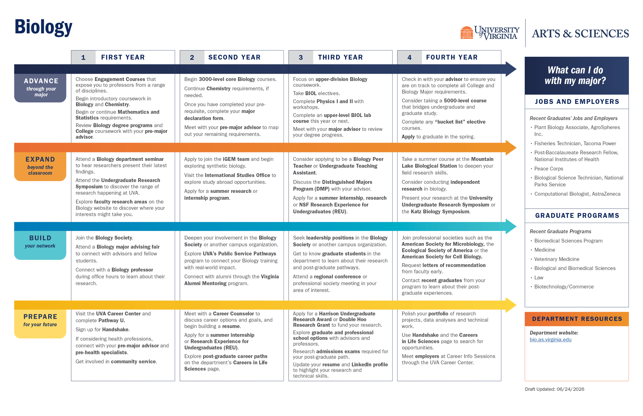
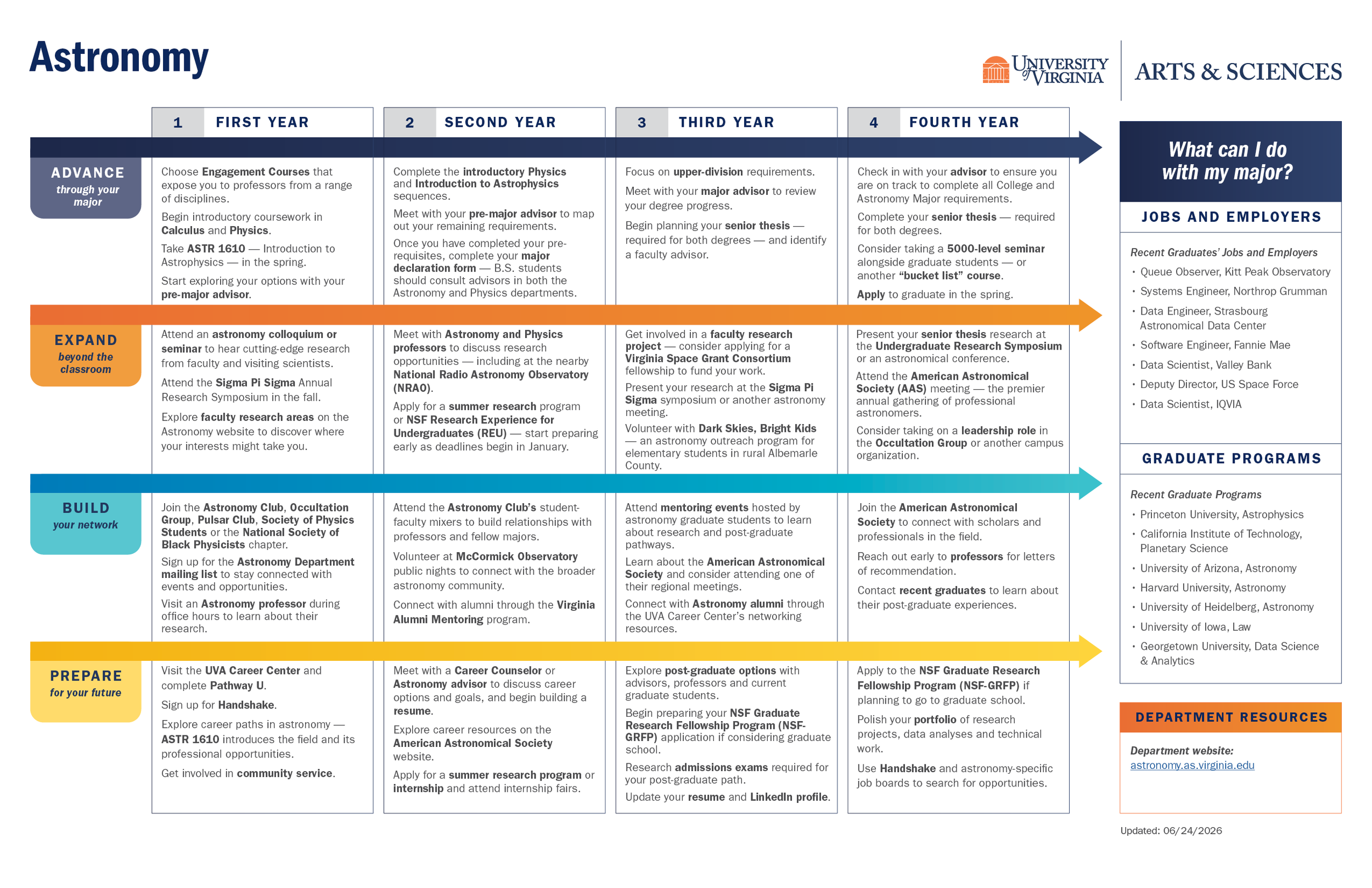
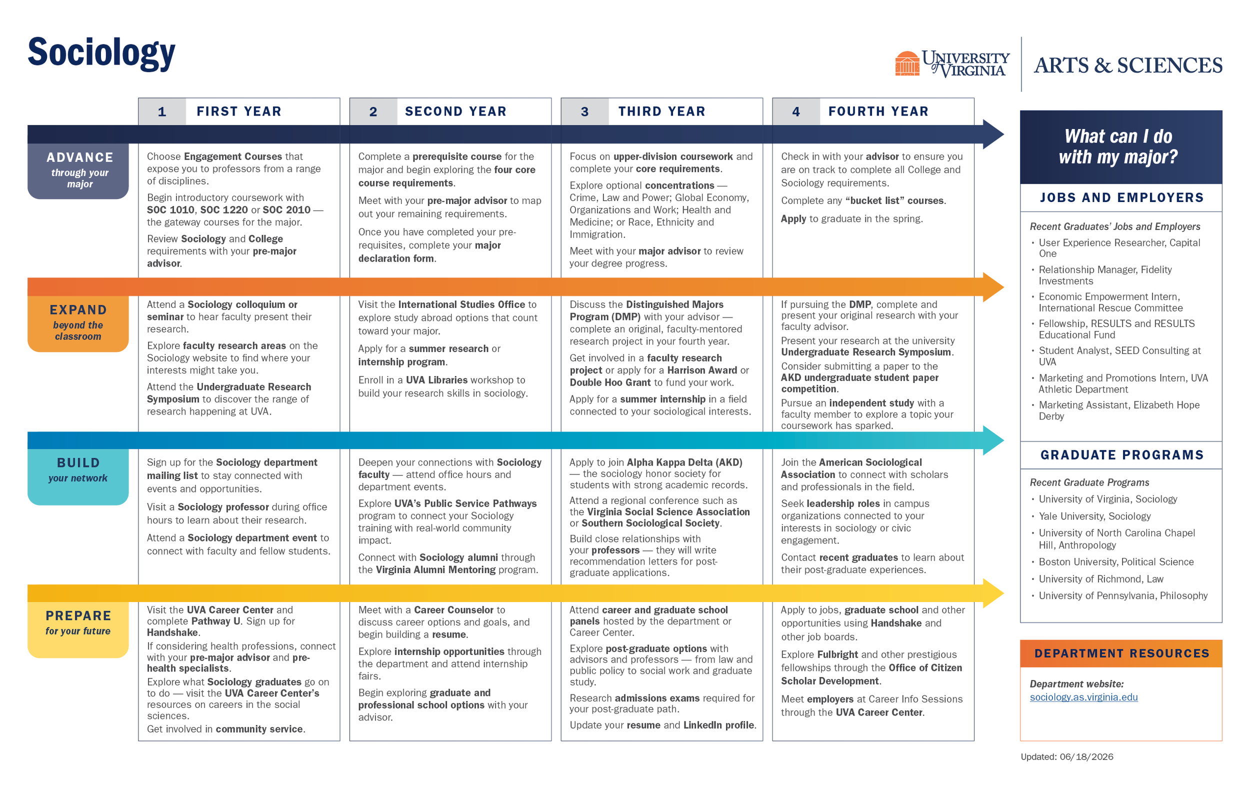
I developed a core visual system that organized each student's potential four-year journey around four themes: advancing through the major, expanding beyond the classroom, building a network, and preparing for the future. Color-coded sections, consistent year-by-year layouts, and a clear information hierarchy made complex academic guidance easier to navigate, while program introductions, student testimonials, and discipline-specific opportunities gave each map its own voice.
The result was a resource designed not just to explain degree requirements, but to help students see the broader possibilities of an academic experience.
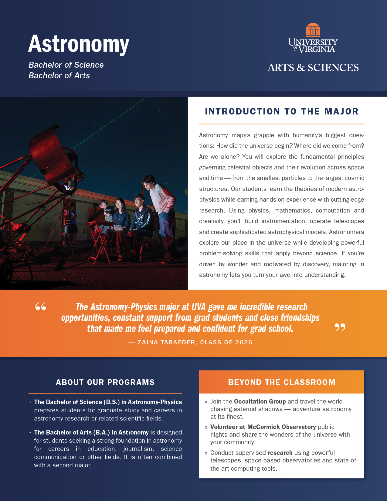
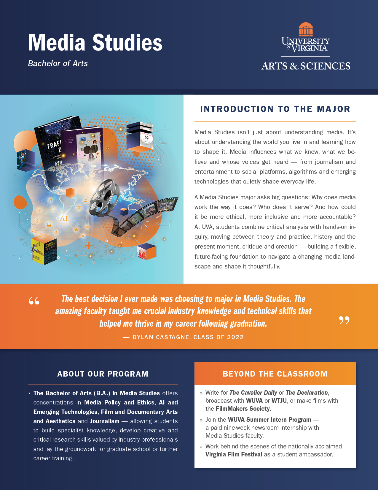
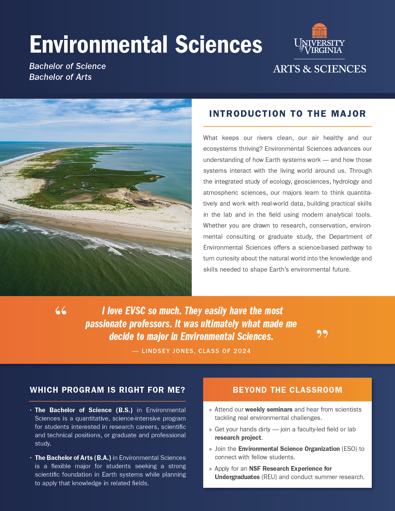
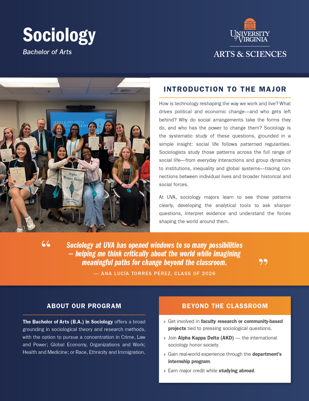
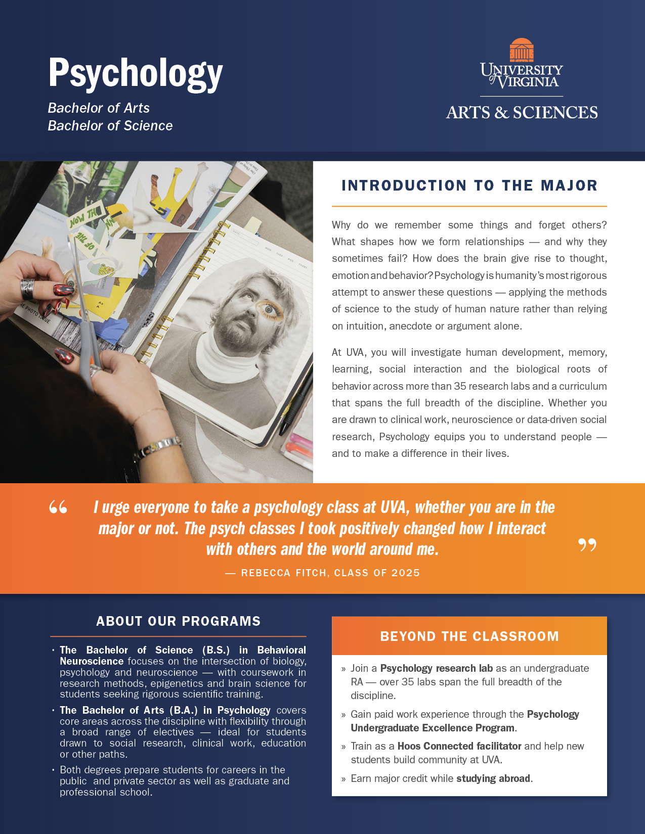
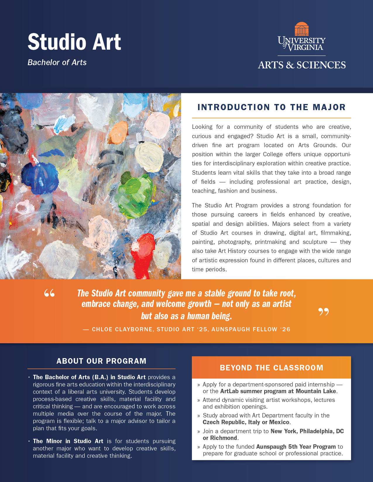
Above: Cover pages are designed to showcase each major’s distinctive traits through compelling imagery, student voices, and inspiring introductory overviews.
Below: The interior spread of each Major Map helps students envision their four-year path in the program and beyond, featuring a spotlight on jobs and employers as well as graduate programs. Compare the four diverse programs highlighted here — same structure, flexible contents.
Designed for discovery
Major Maps were designed to work at a glance and in depth. On the outside, distinctive covers, eye-catching photography, and first-person testimonials invite students to connect with a program and get a feel for its culture. Inside, a consistent four-year framework organizes academic milestones, research, advising, career preparation, and opportunities beyond the classroom.
This two-layer approach makes the maps useful in different ways. Students can quickly browse the series, compare programs, or discover a major they hadn't previously considered, then open a map to explore the details. Within the College's advising framework, the maps also give students and advisors a shared starting point for conversations about academic interests and future possibilities.
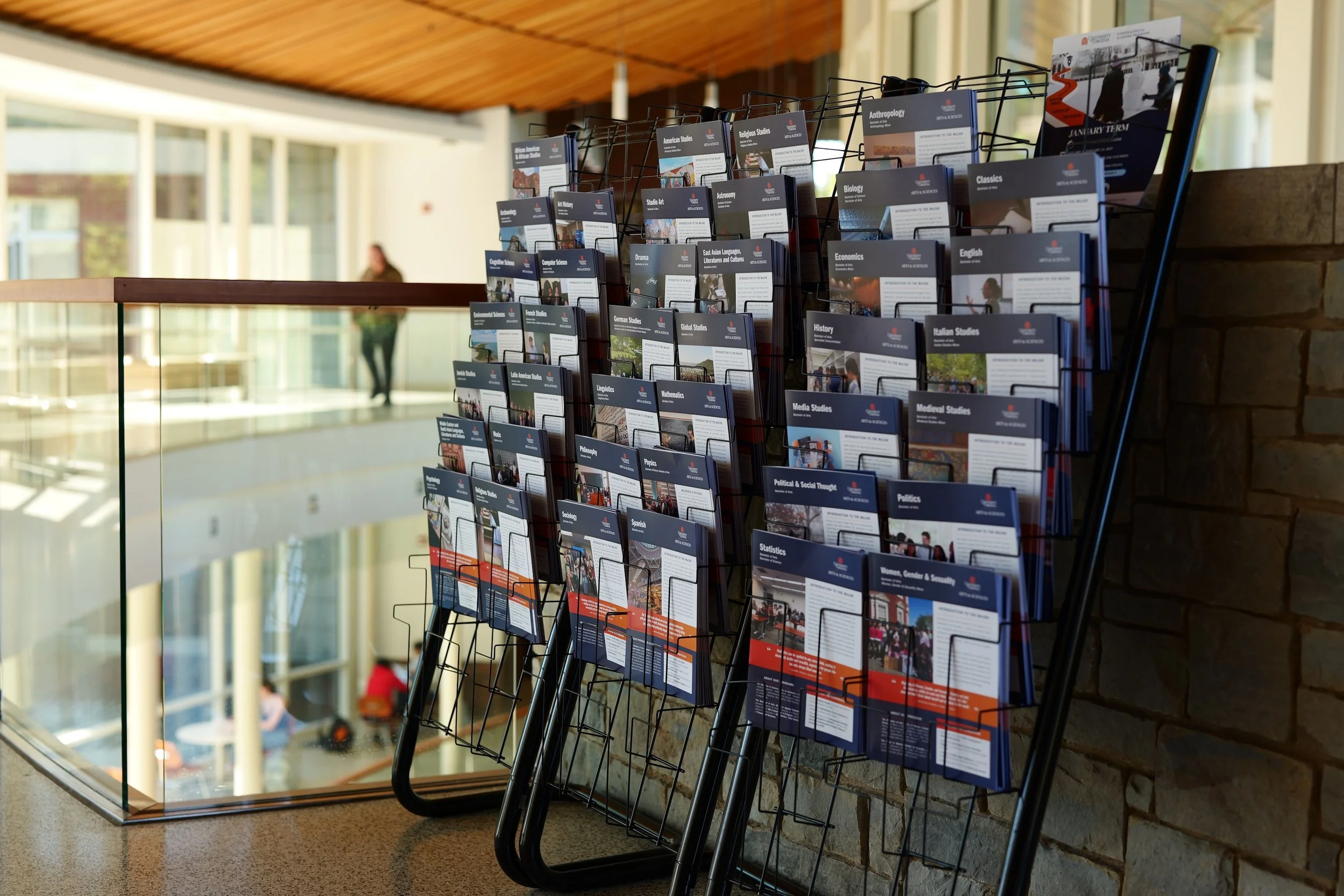
On the racks for browsing: In addition to use in advising sessions, Major Maps are designed to be a browsable collection that make academic possibilities visible in everyday student spaces. Photograph by Evan Kutsko, UVA Arts & Sciences.
Collaboration at scale
An overview of the initial 39 Major Maps.
Bringing the initiative to life required close collaboration across academic departments, the Office of Undergraduate Education, the creative team, and College leadership.
As lead designer, I developed the template and guided creative direction, design implementation, and print production, helping align stakeholders, navigate competing priorities, and keep the project moving through multiple rounds of review and approval.
Each map had to meet shared design and content standards while reflecting the needs of its individual program. Advising Fellows from the Office of Undergraduate Education served as liaisons to departments, gathering content and building relationships with faculty and staff. Colleagues on the creative team coordinated photography and copy editing, while Directors of Undergraduate Programs brought together departmental input and content. I worked across these efforts to translate diverse perspectives into a cohesive, polished series.
Balancing consistency and individuality
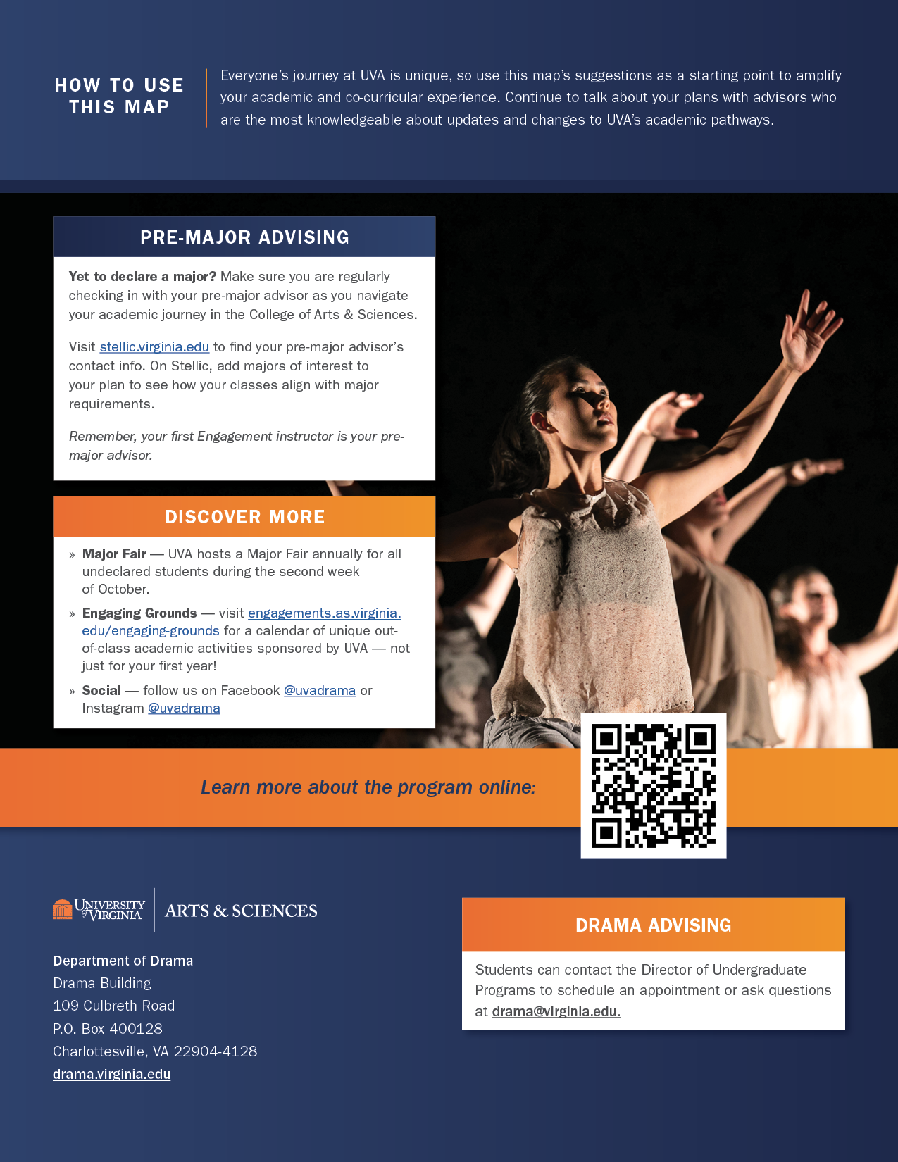
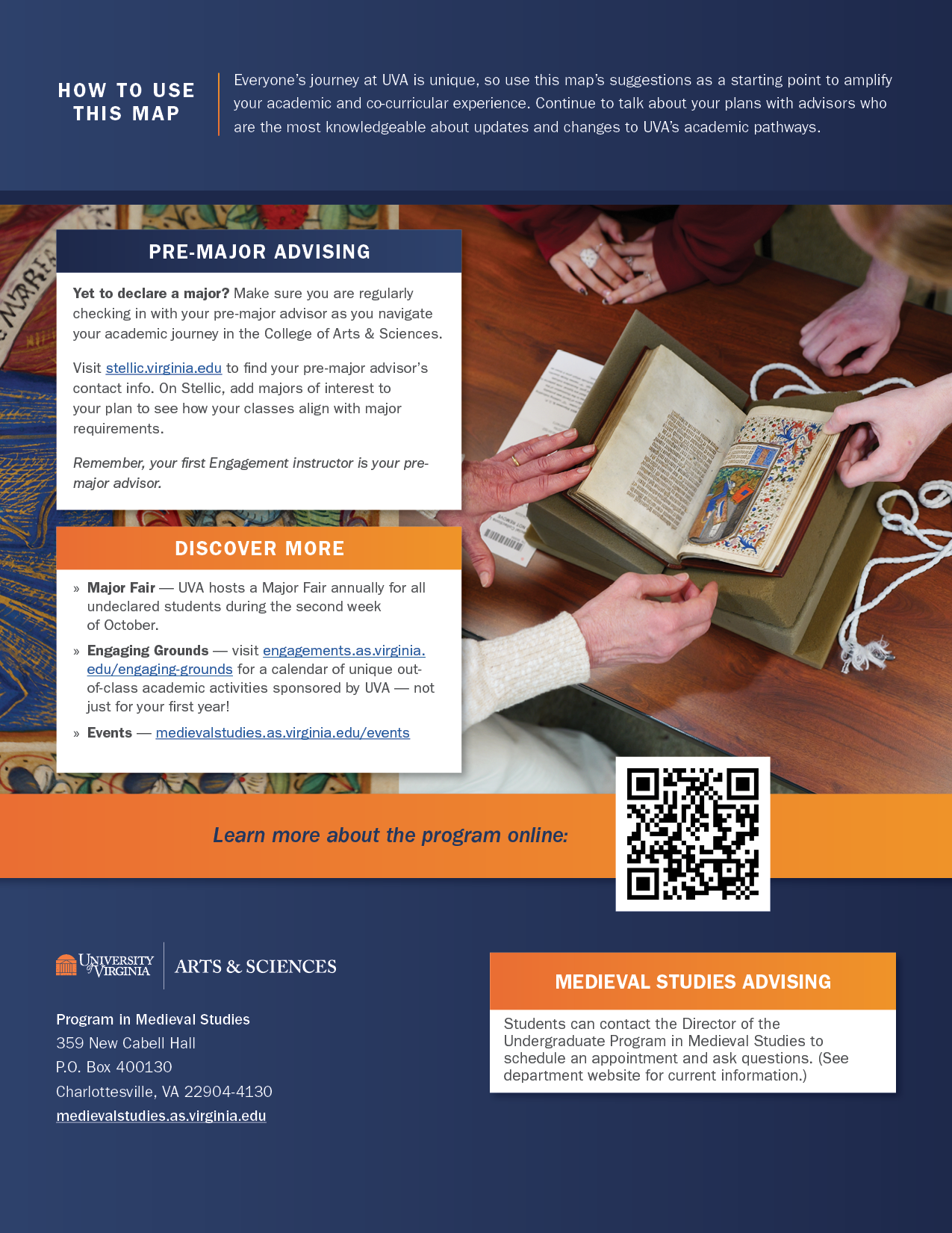
A key creative challenge was building a recognizable system across dozens of programs without making every map feel the same. I established consistent layouts, information hierarchy, and content structures while allowing program-specific photography, student testimonials, and academic opportunities to give each map its own character.
Maintaining that balance required flexibility throughout production. Department submissions varied in format, completeness, and level of detail, while feedback and competing priorities affected the review process. Working closely with colleagues in the Office of Undergraduate Education and the creative team, I helped bring content into alignment with the design framework, refine photography, and move proofs through review and approval. The result was a cohesive series that made programs easier to explore and compare while preserving what made each one distinct.
A look behind the scenes: From concept to reality
Each map was the culmination of a process designed to bring a consistent, student-centered approach to academic wayfinding across the College's programs.
Concept. The Wayfinding committee benchmarked approaches at peer institutions and developed the concept for a four-year map that would help students envision their academic paths. I translated that concept into a visual direction and design system that could scale across the College's diverse programs.
Pilot. I created the maps’ structure and refined the design through test-case meetings with the Major Maps team and pilot departments. The goal was to make maps easy to navigate and compare while leaving room for each program's distinct identity, photography, and student perspectives. Information hierarchy, color coding, and a consistent layout provided the framework; feedback from departments, students, and advisors helped shape the final template.
Content Development. With the framework established, the team developed a standardized worksheet and photography process to help departments contribute program-specific information within shared content and design guidelines.
Production. Each map moved through a multi-stage process of content editing, photography, design implementation, program-director review, and departmental sign-off. I led design implementation and print production, reviewed and edited photography, and helped direct photo shoots to ensure the imagery supported the overall creative vision.
Future Iterations. The project established a documented editorial framework, visual style, and reusable templates to support future updates. These shared resources provide a foundation for bringing additional programs into the series and keeping the maps current as academic offerings evolve.
The outcome of this extensive collaboration was more than a set of publications. It was a repeatable design system, supported by shared templates and standards, that could adapt to individual programs and evolve with the College's academic offerings.
Results: A model for academic wayfinding
The first iteration yielded 39 completed Major Maps, produced as 11 × 17-inch folded publications, with 16,800 copies printed and distributed to key areas around Grounds.
The project has earned praise across Arts & Sciences and the University, and its influence has extended beyond the original aim: pan-University wayfinding initiatives are now looking to the success of Major Maps as a model for broader academic wayfinding efforts that help students navigate opportunities across schools and disciplines.
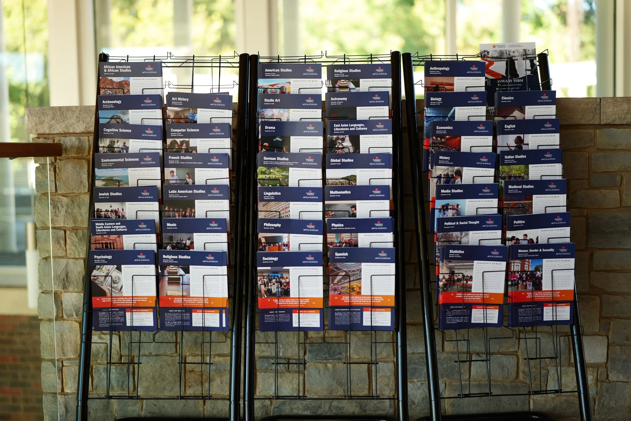
Showcasing the breadth of academic possibilities: one college-wide system, 39 completed program maps. Photograph by Evan Kutkso, UVA Arts & Sciences.